Flood of 1955
Permanent Online Exhibit
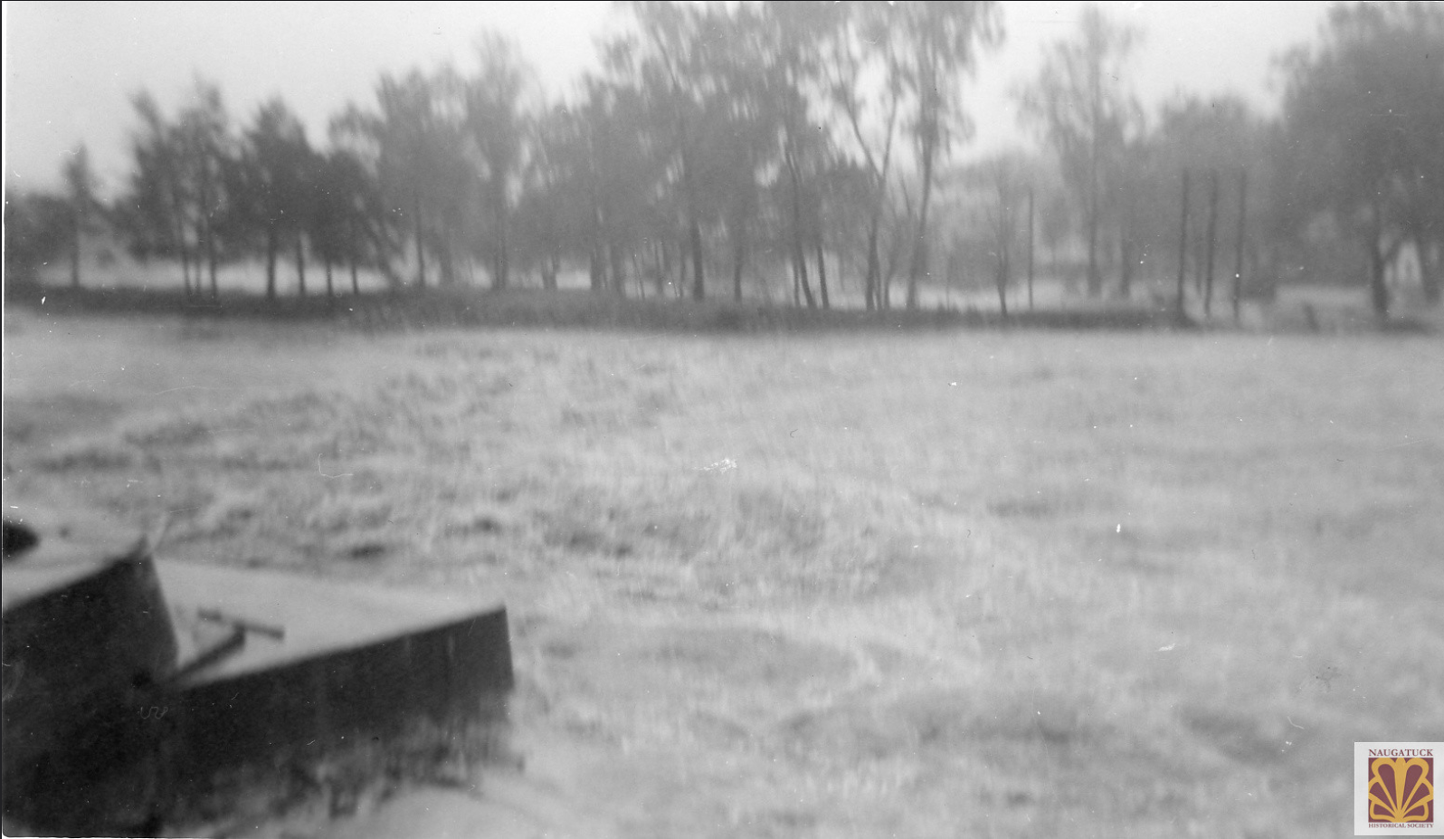
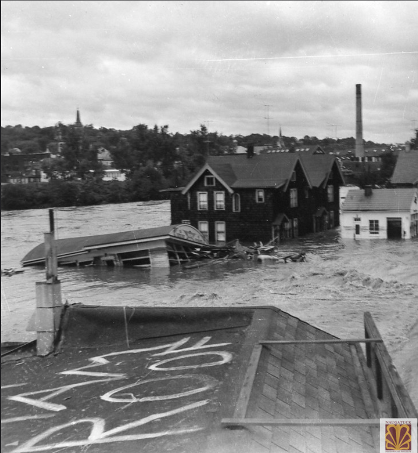
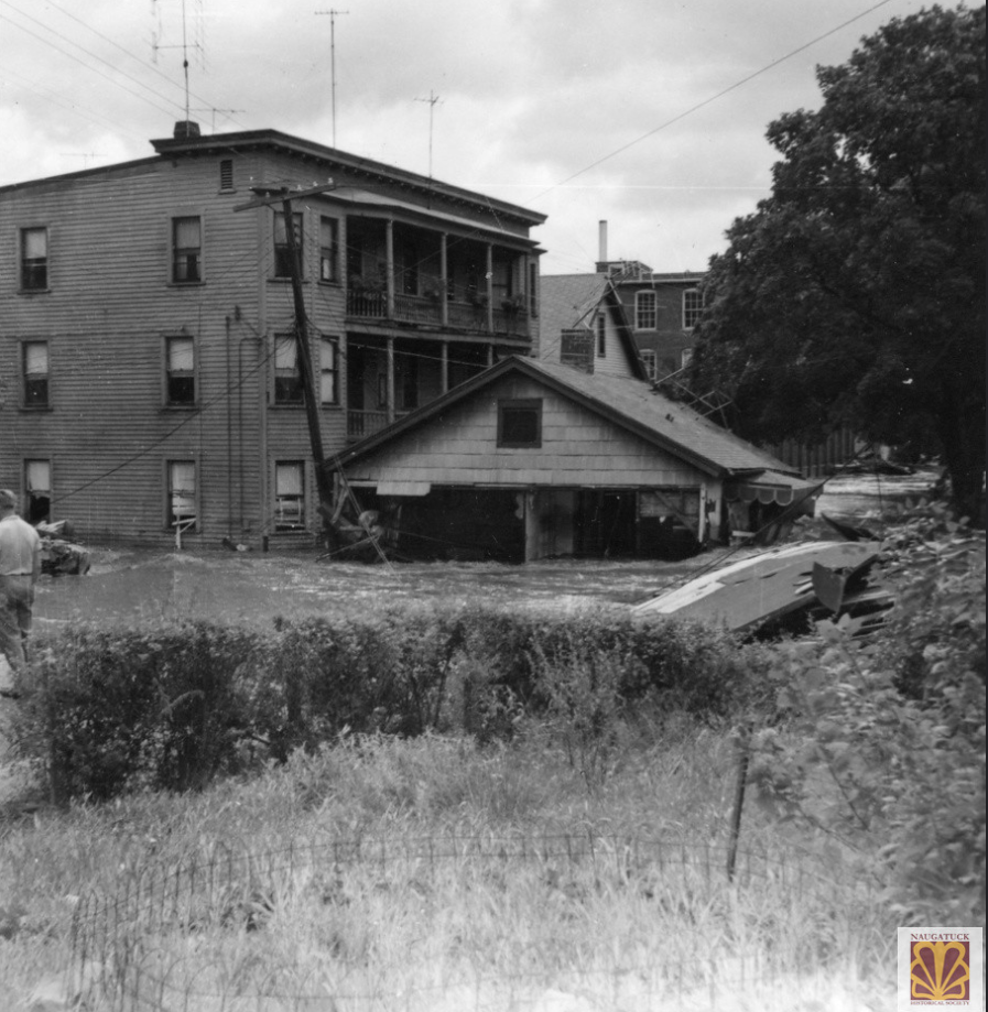
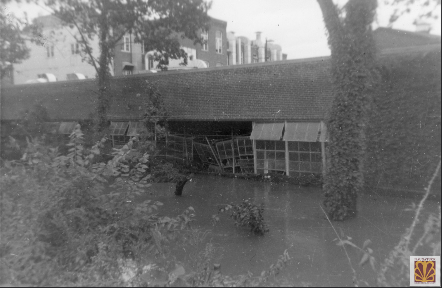
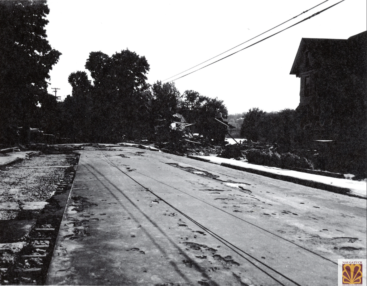
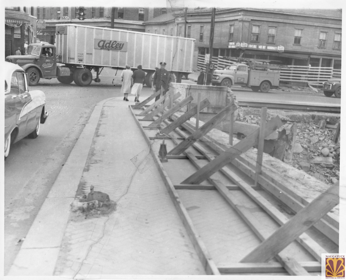
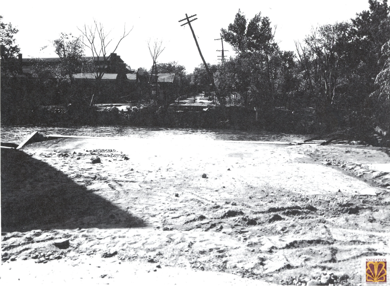
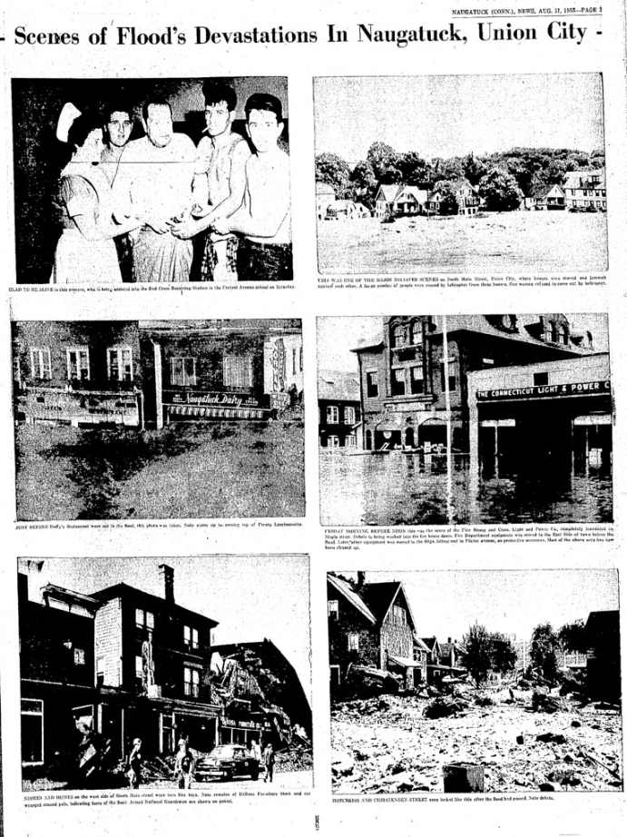
The Naugatuck River overflowed its banks on August 19, 1955, devastating towns along its path. This catastrophic event resulted from back-to-back hurricanes, Connie and Diane, which dumped record-setting rainfall across Connecticut. Hurricane Connie arrived first, saturating the soil with 4-6 inches of rain. Less than a week later, Hurricane Diane added more than a foot of rain, leading to rivers across the state, including the Naugatuck River, spilling over and causing severe flooding.
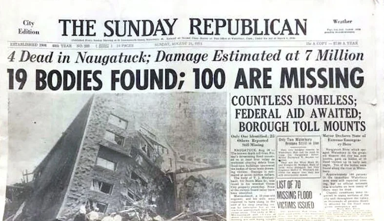
Connecticut experienced 87 deaths due to the floods, with eight fatalities occurring in Naugatuck. Survivors often referred to the flood as “Black Friday” due to the destruction it caused, particularly on August 19, when rivers across several towns burst their banks in the early hours of the morning. Damage was extensive, and recovery efforts stretched for months, with the flood forever altering the physical and economic landscape of Naugatuck.
Later in the same year, a second, more minor flood hit Connecticut on October 15-16, 1955, further straining the recovery efforts in many areas, including Naugatuck.
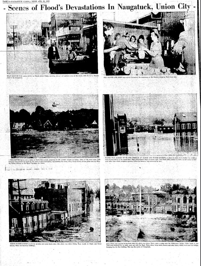
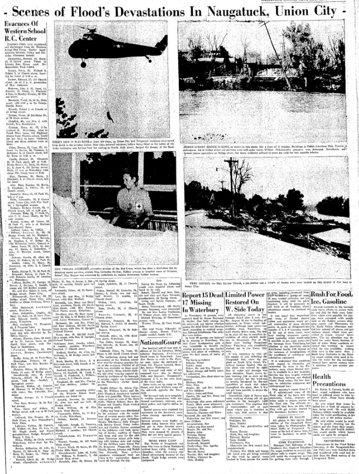
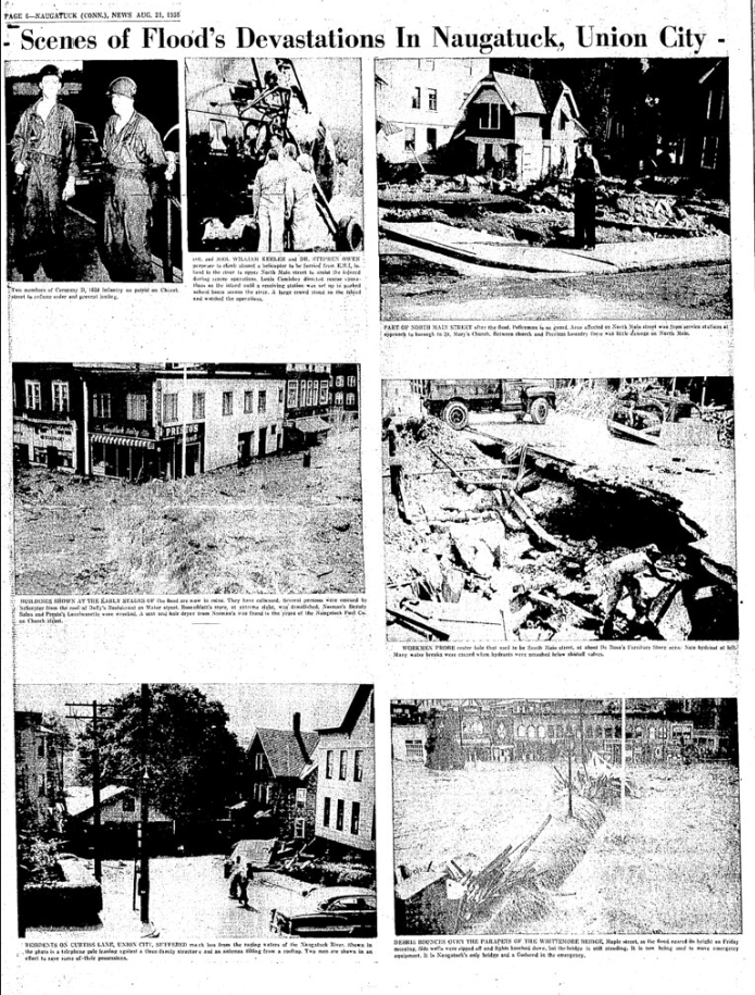
The photographs in this collection, generously donated to the Naugatuck Historical Society, document the impact, aftermath, and recovery from these floods, as well as newspaper coverage from the time. The 1955 floods remain a defining moment in the town’s history, symbolizing resilience in the face of disaster.
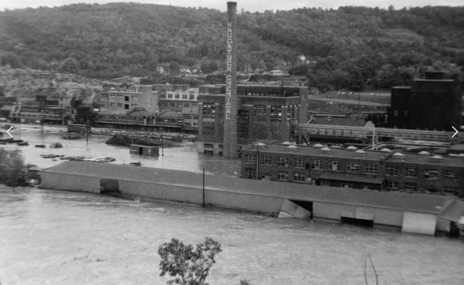
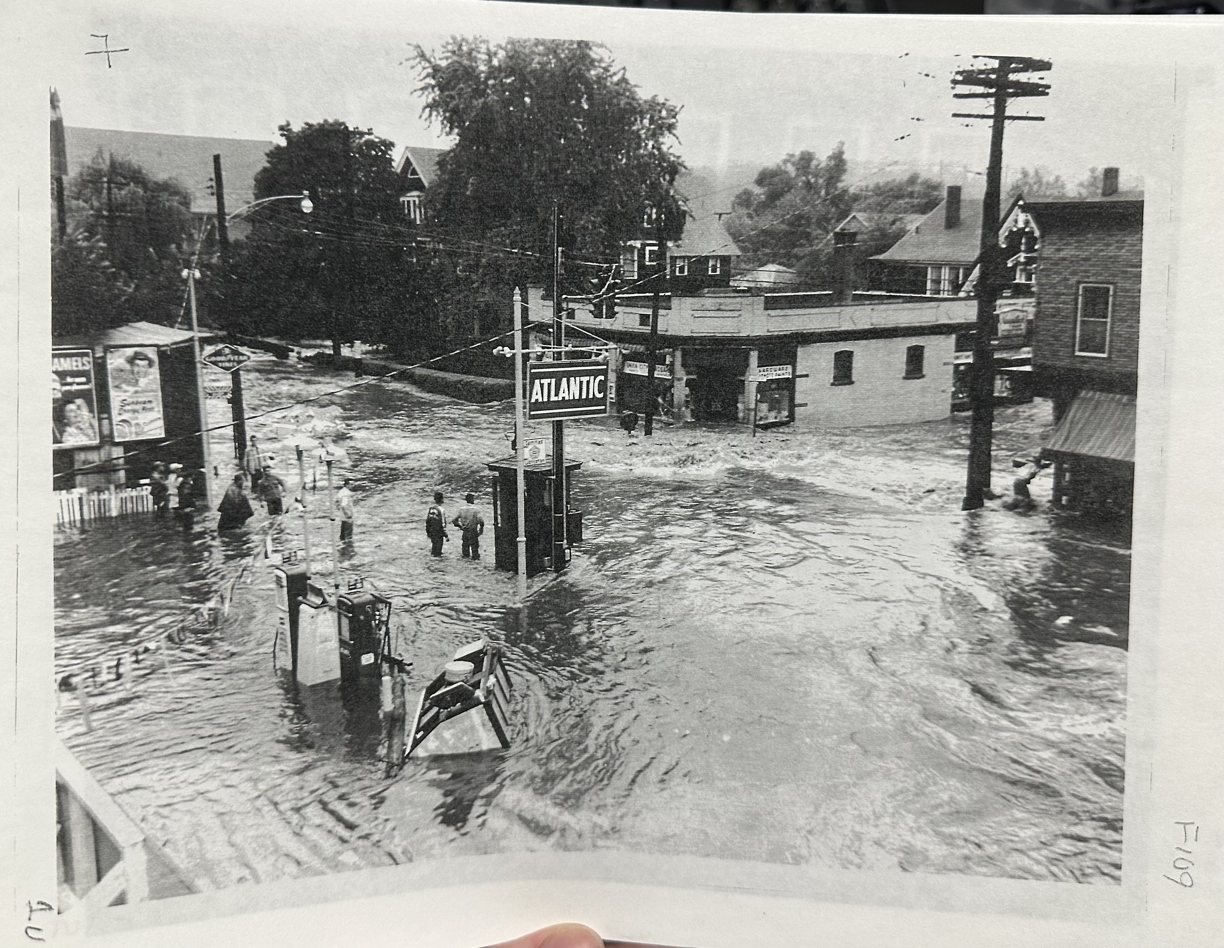
Looking at the intersection of Bridge and North Main St.

Looking at North Main St. before height of flood which wiped out many buildings shown in this photo

Washed out used and new car dealer lot on North Main St.

North Main St. - Union City

North Main St.
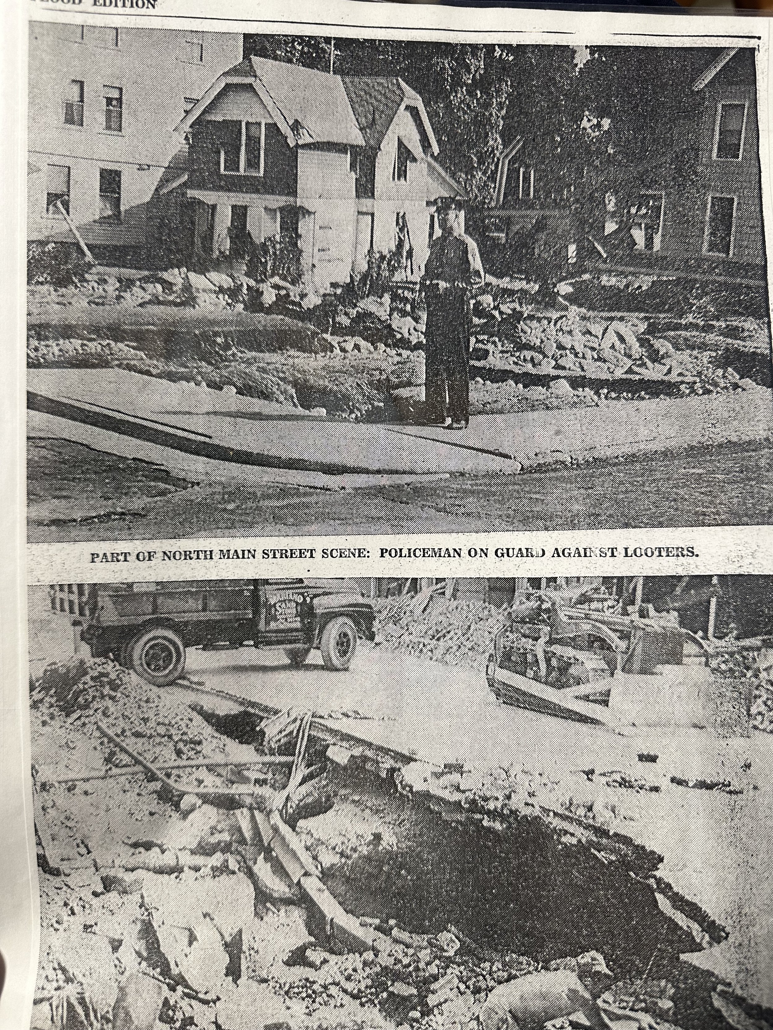
North Main St.

Down Woodbine St. toward North Main St.

North Main St.

City Hill & Bridge St. intersection on North Main St.

Down Myrtle Ave. showing church

Union City Main St.

Union City

Union City


St. Paul's Lutheran Church

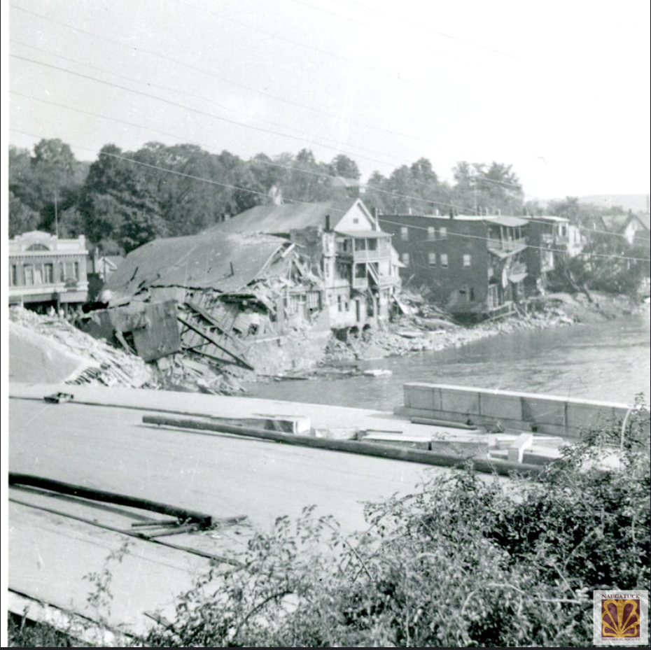
Bridge St. bridge gone


Union City Pharmacy - North Main St.
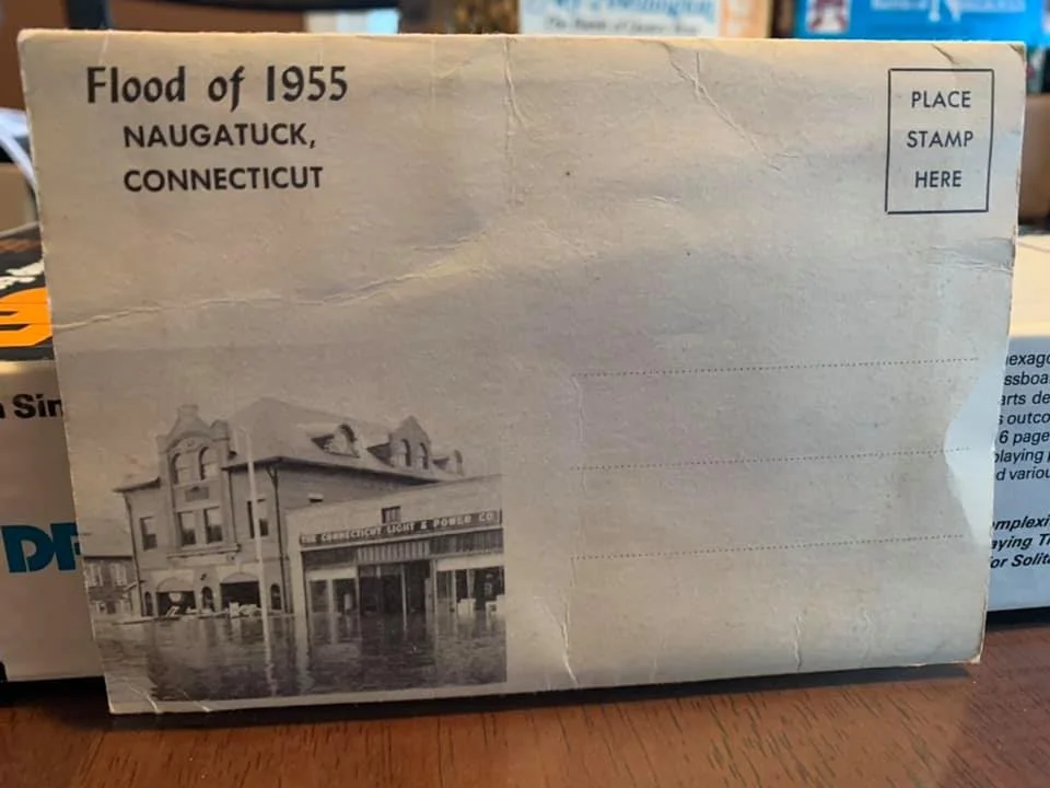
Naugatuck 1955 flood picture mailer booklet. Contains 24 B&W photos of Naugatuck during the flood.
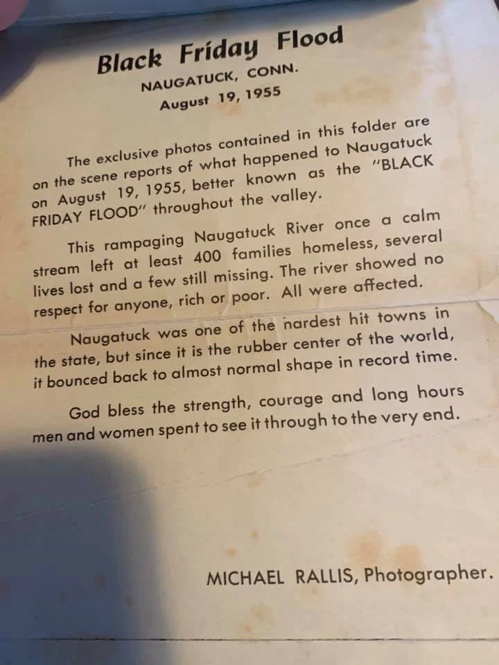
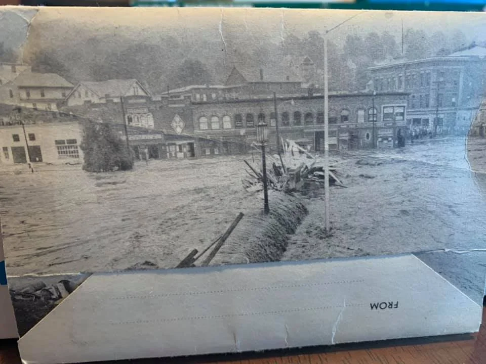
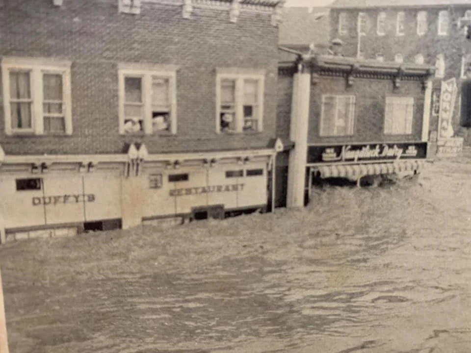
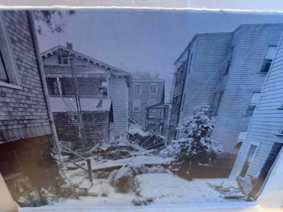
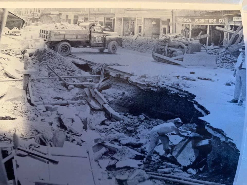
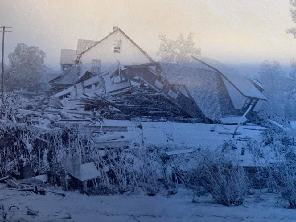
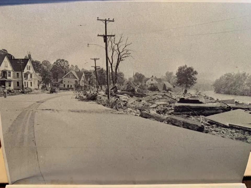
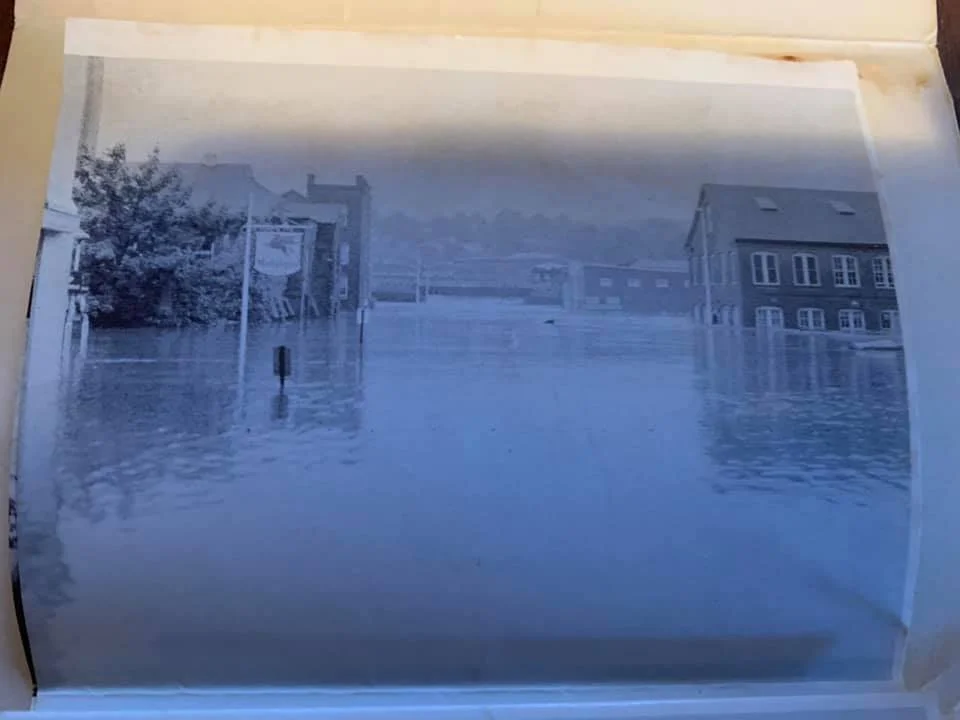
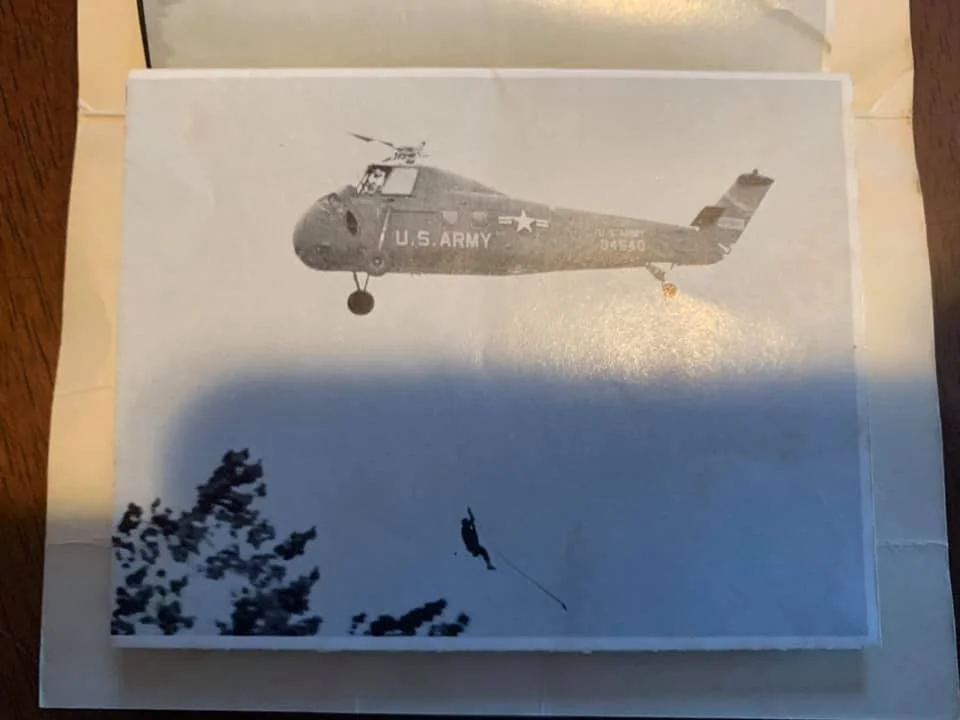
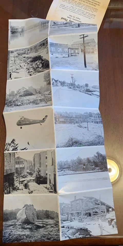
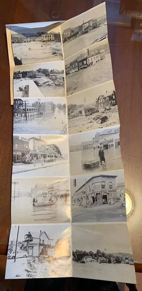
-
![Flood023]()
Looking west across South Main Street. U.S. Rubber Company warehouse at corner of Water street and Church Street in background.
-
![Flood247]()
Across Naugatuck River to rear of Curtis Street, same location as Flood243 in this album.
-
![Flood243]()
View across Naugatuck River to rear of Curtis Street. Same location as Flood034 and Flood066 in this album.
-
![Flood181]()
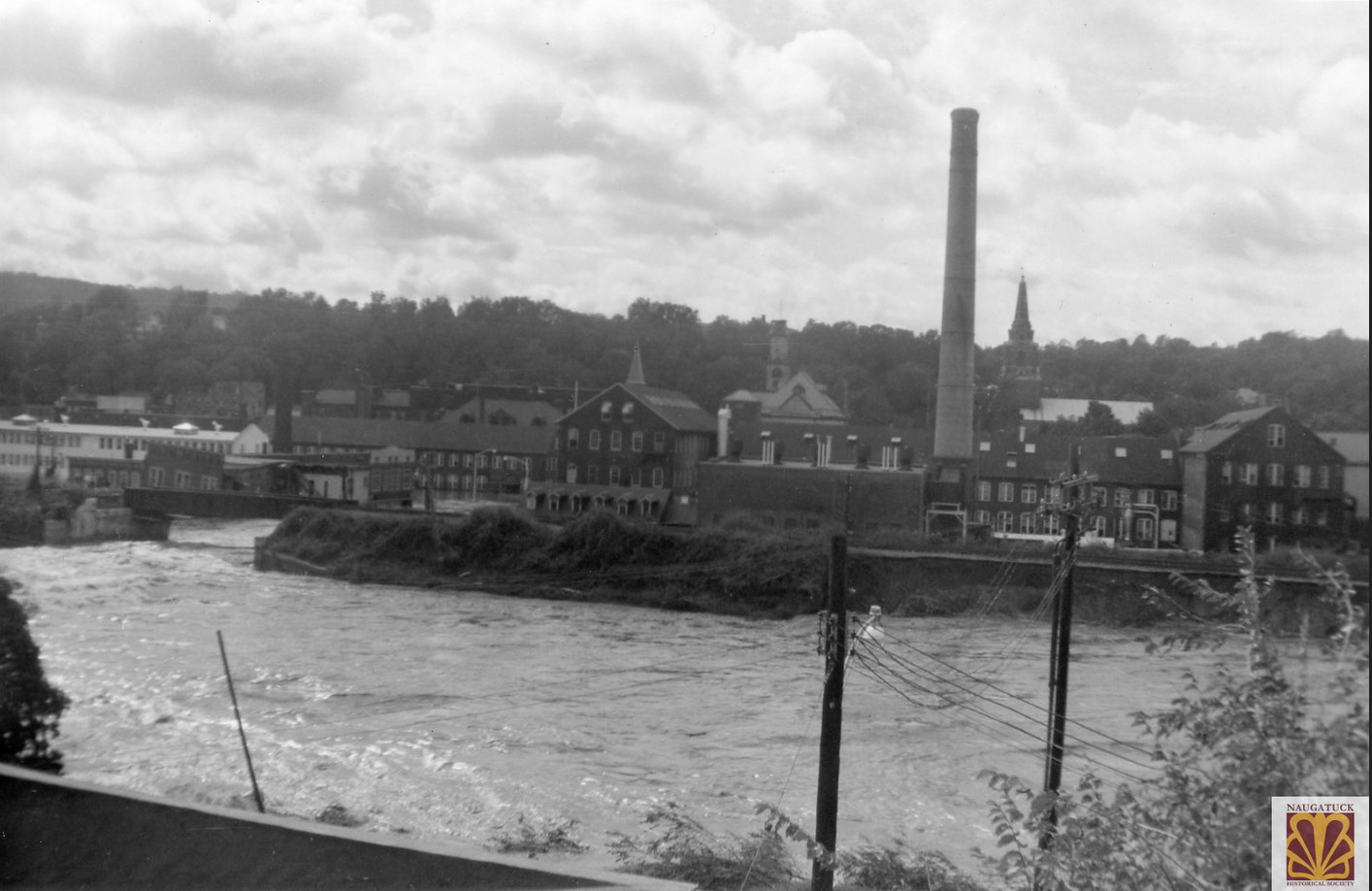
Naugatuck River flooded, view from High Street.
-
![Flood178]()
Across the Naugatuck River to Recreation Field, now Rotary Field.
-
![Flood171]()
Location unknown, possibly North Main Street area.
-
![Flood169]()
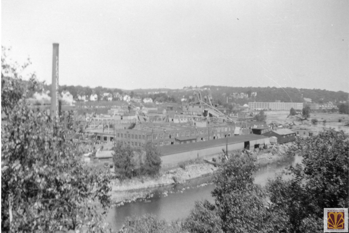
Looking north, Chemical smoke stack in background. Comment on photograph "Never that flooded-the day after."
-
![Flood147]()
Naugatuck River, location unknown.
-
![Flood128]()
Naugatuck River flooding Naugatuck Chemical. View from South Main Street looking toward the end of Elm Street.
-
![Flood124]()
View across Naugatuck River to what is now Parcel C and the Post Office location. Intersection of Water and Maple streets on left edge in center.
-
![Flood111]()
Looking south over flooding Naugatuck River. U.S. Rubber warehouse in center.
-
![Flood094]()
Flooding across Recreation field, now Rotary Field.
-
![Flood075]()
View north towards downtown, from same location as Flood074 in this album.
-
![Flood080]()
Closer view, see Flood074, of flooded Naugatuck Chemical plant.
-
![Flood067]()
North Main Street area.
-
![Flood066]()
Naugatuck River, view of rear of Curtis Street, same location as Flood034 in this album.
-
![Flood054]()
Looking south down the Naugatuck River after the flood. Chemical smoke stack on the right.
-
![Flood037]()
Location unknown, possibly North Main Street area.
-
![Flood034]()
Naugatuck River, rear of Curtis Street.
-
![Flood033]()
View of flooded Naugatuck River from Recreation Field, now called Rotary Field.
-
![Flood025]()
South Main Street at Hotchkiss Street, partial sign "I am on roof".
-
![Flood032]()
View across the river, Naugatuck Garage on South Main Street.
-
![Flood050]()
Oak Street looking at Maple Street and South Main Street.
-
![Flood070]()
Oak Street looking towards South Main Street. Building on left is Ideal Meat Market.
-
![Flood071]()
Naugatuck Fire Department Engine 1 on Oak Street.
-
![Flood084]()
Naugatuck Fire Department Engine 1 on Oak Street, National Guard helicopter.
-
![Flood086]()
View across the Naugatuck River to what is now Parcel C. Railroad station on right edge.
-
![Flood106]()
South Main Street and Oak Street during the flood.
-
![Flood107]()
Army helicopter over Whittemore Memorial Bridge. Sikorsky had a U.S. Army helicopter that was almost ready to be shipped. Two of their employees were flying it, not army personnel.
-
![Flood108]()
Crowd on Oak Street.
-
![Flood109]()
Army helicopter over South Main Street area. Sikorsky had a U.S. Army helicopter that was almost ready to be shipped. Two of their employees were flying it, not army personnel.
-
![Flood114]()
Oak Street and South Main Street.
-
![Flood115]()
Undated photograph of South Main Street looking north sometime before the flood. Compare to Flood098 in this album.
-
![Flood116]()
South Main Street looking north. Buildings on the right removed after the flood for Route 8.
-
![Flood118]()
South Main Street and Hotchkiss Street. The two brown houses are still standing today.
-
![Flood119]()
Oak Street, South Main Street, Maple Street intersection.
-
![Flood123]()
South Main street.
-
![Flood134]()
Looking north on South Main Street towards Whittemore Memorial bridge.
-
![Flood144]()
South Main Street near Hotchkiss Street.
-
![Flood151]()
Location unknown, possibly South Main Street area.
-
![Flood193]()
Hotchkiss Street towards Recreation Field, now Rotary Field.
-
![Flood197]()
South Main Street and Hotchkiss Street.
-
![Flood198]()
Looking north on South Main Street toward Whittemore Memorial Bridge. Compare to Flood115 in this album.
-
![Flood252]()
Flooded house, South Main Street.
-
![Flood095]()
Recreation field (Rotary Field) and Hotchkiss Street flooded.
-
![Flood290]()
Flood damage near South Main street.
-
![Flood141]()
Recreation Field (Rotary Field) on Hotchkiss Street.
-
![Flood282]()
Recreation Field (Rotary Field) on Hotchkiss Street.
-
![Flood129]()
Hotchkiss Street.
-
![Flood017]()
-
![Flood018]()
-
![Flood026]()
Corner of Water Street (right) and Maple Street (left). The area is now known as Parcel C.
-
![Flood053]()
Gate at Naugatuck Chemical, Elm Street.
-
![Flood060]()
Water Street looking south towards Maple Street. The Post Office is now on this site.
-
![Flood065]()
Rubber Shop, Water Street.
-
![Flood081]()
Clean up after the flood, Maple Street looking west toward the Green.
-
![Flood100]()
Cleaning up after the flood, Naugatuck Chemical.
-
![Flood110]()
Naugatuck Chemical plant flooded, view from South Main Street near High Street.
-
![Flood113]()
Naugatuck Chemical.
-
![Flood127]()
Clean up at Naugatuck Chemical. Note pile of tires in background, part of the rubber reclaiming work done there.
-
![Flood150]()
U.S. Rubber warehouse. Building constructed less than a year before the flood.
-
![Flood167]()
Loading docks at U.S. Rubber warehouse, Elm Street and Rubber Avenue.
-
![Flood172]()
Flood damaged stock outside U.S. Rubber warehouse on Elm Street.
-
![Flood182]()
Flood damaged stock at the U.S. Rubber warehouse, Elm Street.
-
![Flood214]()
Naugatuck Chemical, looking west, from Elm Street.
-
![Flood231]()
Flood damage inside U.S. Rubber plant.
-
![Flood232]()
Flood damage inside U.S. Rubber plant.
-
![Flood233]()
Flood damage inside U.S. Rubber plant.
-
![Flood234]()
Flood damage inside U.S. Rubber plant.
-
![Flood235]()
Flood damage inside U.S. Rubber plant.
-
![Flood236]()
Flood damage inside U.S. Rubber plant.
-
![Flood237]()
Flood damage inside U.S. Rubber plant.
-
![Flood238]()
Gate located east of fire station.
-
![Flood239]()
Maple Street behind Town Hall.
-
![Flood246]()
Water Street.
-
![Flood265]()
View across the river of flooded Naugatuck Chemical plant.
-
![Flood266]()
Flooded rail cars used by the Naugatuck Chemical plant.
-
![Flood267]()
Boat on Elm Street, next to warehouse. Caption reads "New warehouse-note water line-Jim Wrinn(?) in back of boat."
-
![Flood271]()
Flood damaged stock at U.S. Rubber warehouse, Elm Street.
-
![Flood273]()
View of Naugatuck Chemical after the flood.
-
![Flood281]()
Naugatuck Chemical smoke stack.
-
![Flood283]()
Looking east at flooded Naugatuck Chemical plant, from South Main Street
-
![Flood284]()
Looking north from South Main Street, flooded chemical plant. Warehouse in background.
-
![Flood285]()
Looking east across the river. Flooded Naugatuck Chemical plant.
-
![Flood289]()
Flood damage at Naugatuck Chemical.
-
![Flood002]()
Myrtle Avenue "in between our homes."
-
![Flood004]()
Rear of Myrtle Avenue on left, rear of Woodbine Street on right.
-
![Flood009]()
North Main Street at corner of Myrtle Avenue (left).
-
![Flood010]()
North Main Street from Myrtle Avenue.
-
![Flood015]()
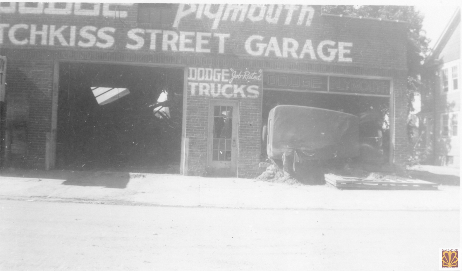
Hotchkiss Street Garage dated 8/30/1955.
-
![Flood019]()
Unknown location, possibly North Main Street area.
-
![Flood021]()
Unknown location, possibly North Main Street area.
-
![Flood024]()
Unknown location, possibly North Main Street area.
-
![Flood038]()
Unknown location, possibly North Main Street area.
-
![Flood039]()
Unknown location, possibly North Main Street area.
-
![Flood040]()
Collapsed building on South Main Street.
-
![Flood041]()
Collapsed building, location unknown.
-
![Flood042]()
Location unknown, possibly North Main Street.
-
![Flood046]()
Intersection of South Water Street and Maple Street (left).
-
![Flood048]()
Looking west on Maple Street from South Main Street. Old Town Hall on top to right of center.
-
![Flood055]()
Looking north along Naugatuck River. Damage to Naugatuck Chemical on left.
-
![Flood059]()
Debris from flood, possibly lumberyard on Bridge Street.
-
![Flood063]()
North Main Street. Caption on back "No gas station, about 15 homes gone, 3 lives lost here."
-
![Flood069]()
Maple Street (right) and South Main Street.
-
![Flood082]()
Location unknown, possibly North Main Street area.
-
![Flood088]()
Rear of Yeaton's a popular location in town. Whittemore bridge in foreground.
-
![Flood089]()
Rosenblatt's on Maple Street.
-
![Flood090]()
Location unknown, possibly North Main Street or Curtis Street.
-
![Flood091]()
South Main Street, Yeaton's on far right.
-
![Flood099]()
Maple Street and Water Street, location of Nardelli's today.
-
![Flood117]()
Hotchkiss Street Garage.
-
![Flood126]()
Location unknown, possibly North Main Street area.
-
![Flood130]()
North Main Street near South Main Street. Route 8 is now over this spot.
-
![Flood132]()
South Main street from train tracks. Caption on back "Look at Baz Block!"
-
![Flood138]()
North Main Street and Myrtle Avenue, house moved into road.
-
![Flood140]()
Water Street looking towards Maple Street.
-
![Flood174]()
South Main Street looking towards Maple Street.
-
![Flood175]()
South Main Street downstream from Whittemore Memorial bridge.
-
![Flood183]()
North Main street near Woodbine Street.
-
![Flood184]()
North Main Street.
-
![Flood185]()
North Main Street, near Naugatuck Manufacturing Company.
-
![Flood186]()
North Main Street near Wood Street.
-
![Flood187]()
Possibly North Main Street area. Caption "Our front porch".
-
![Flood188]()
Possibly North Main Street area. Caption on back "Corner our street".
-
![Flood190]()
Possibly North Main Street area. Caption on back "Corner our street".
-
![Flood195]()
North Main Street.
-
![Flood200]()
Unknown location, possibly North Main Street area.
-
![Flood203]()
Unknown location, possibly North Main Street area.
-
![Flood206]()
Damage to property, North Main Street near Myrtle Avenue.
-
![Flood209]()
Destroyed home on North Mains Street.
-
![Flood241]()
View from train tracks towards South Main Street. Part of Whittemore Memorial bridge on far left.
-
![Flood245]()
From Whittemore Bridge looking to South Main Street.
-
![Flood249]()
Looking west on Maple Street, Water Street on left.
-
![Flood250]()
South Main Street from the train tracks.
-
![Flood255]()
Flood debris on Water Street, Lewis Engineering center near top.
-
![Flood264]()
North Main Street and Woodbine Street.
-
![Flood036]()
Damaged rail tracks along Elm Street. Ward Street on far right.
-
![Flood012]()
Car of four mounted photographs show flood damage on South and North main Streets.
-
![Flood287]()
Helicopter Rescuer - Joseph Bellemare was flown between houses to cut holes in people's roofs so they could escape from their attics.
-
![Flood296]()
Helicopter North Main Street area. Sikorsky had a U.S. Army helicopter that was almost ready to be shipped. Two of their employees were flying it, not army personnel.
-
![Flood078]()
Helicopter rescue, location unknown.
-
![Flood001]()
Myrtle Avenue
-
![Flood003]()
Rear of Myrtle Avenue
-
![Flood005]()
Woodbine Street looking towards North Main Street
-
![Flood006]()
Rear of Myrtle Avenue
-
![Flood007]()
Woodbine Street looking towards North Main Street. The middle building on the right is now the location of Cumberland Farms.
-
![Flood008]()
Looking down Woobine Street. The middle building on the right is now the location of Cumberland Farms.
-
![Flood011]()
Woodbine towards North Main Street. The while building on the right in foreground is now the location of Cumberland Farms.
-
![Flood020]()
Location unknown. Note on back; “I am in the lower window.”
-
![Flood022]()
Whittemore bridge from roof on South Main Street.
-
![Flood029]()
Union City foot bridge
-
![Flood030]()
Union City foot bridge
-
![Flood035]()
Note on back “Hop Brook “Iron Bridge” near Glass Shop.”
-
![Flood056]()
Flooded home on North Main Street.
-
![Flood057]()
North Main Street and Myrtle Avenue.
-
![Flood058]()
Curtiss Street looking north. The Corner Tavern would be to the right out of the frame.
-
![Flood062]()
Bridge Street
-
![Flood093]()
Note on back “Union City Bridge (gone) bridge Street flooded.”
-
![Flood131]()
Flooded bridge on Bridge Street.
-
![Flood135]()
Flooded homes, location unknown. Note on back “our house”
-
![Flood136]()
Flooded homes, location unknown
-
![Flood137]()
Looking toward Hop Brook bridge. Church Street and Bridge Street.
-
![Flood143]()
Curtis Street, the Eastern Company foundry (Bridge Street) in background.
-
![Flood189]()
North Main Street
-
![Flood192]()
Unknown location
-
![Flood196]()
Unknown location
-
![Flood253]()
Woodbine Street towards North Main Street.
-
![Flood260]()
Flooded house, location unknown.
-
![Flood261]()
North Main Street and Union Street, people evacuating through the flood waters.
-
![Flood262]()
North Main Street near Union Street. Brick building on left is now the entrance and exit ramp to Route 8.
-
![Flood280]()
South Main in Waterbury looking towards North Marion street in Naugatuck, The Route 8 north Exit 29 ramp is now located here.
-
![Flood286]()
Unknown location.
-
![Flood191]()
North Main Street with Curtis Street in background.
-
![Flood121]()
Curtis Street across the Naugatuck River to rear of the foundry on Bridge street.
-
![Flood061]()
Naugatuck Glass on Bridge Street.
-
![Flood155]()
Church Street from Rubber Avenue.
-
![Flood292]()
Corner Maple Street (right) and Water Street. Note the flood waters are higher then the other view in this album.
-
![Flood028]()
Looking east on Maple Street from Church Street. Flooded fire house on right.
-
![Flood031]()
Looking east on Maple Street from Church Street.
-
![Flood045]()
Water Street looking towards Maple Street. This is now known as Parcel C and the location of the Post Office.
-
![Flood047]()
Maple Street from Church Street.
-
![Flood049]()
Whittemore Memorial bridge under water, view from North Main Street.
-
![Flood052]()
W. J. Megin on Elm Street.
-
![Flood064]()
View from North Main Street near South Main Street.
-
![Flood073]()
Maple Street looking east, old Town Hall to left out of frame.
-
![Flood076]()
North Main Street looking towards Whittemore Memorial bridge. Alcazar Theater on far left. This is now the location of the Route 8 north entrance ramp on Maple Street.
-
![Flood146]()
Park Place looking towards Church Street.
-
![Flood149]()
Maple Street looking towards Whittemore Memorial bridge. Rosenblatt's in building in center.
-
![Flood154]()
Rubber Avenue, Church Street on the left. U.S. Rubber warehouse on right.
-
![Flood194]()
Possibly from roof of Old Fellows building on Maple Street, Whittemore Memorial bridge under water.
-
![Flood240]()
Looking east on Maple Street, flooded fire house on right.
-
![Flood244]()
Water Street, north of Cedar Street.
-
![Flood256]()
Corner Maple Street (right) and Water Street.
-
![Flood258]()
Looking east on Maple Street, Neary building on right.
-
![Flood263]()
Looking east, Whittemore Memorial bridge under water, Odd Fellow building in upper center.
-
![Flood268]()
Flooding at W. J. Megin on Elm Street.
-
![Flood270]()
Looking north on Elm Street.
-
![Flood272]()
W. J. Megin on Elm Street.
-
![Flood293]()
Water flowing over Whittemore Memorial bridge, viewed from train tracks.
-
![Flood294]()
Flood debris on the Whittemore Memorial bridge.
-
![Flood295]()
Water Street looking at Maple Street. Notice people in windows over Duffy's Restaurant.
-
![Flood083]()
Naugatuck River over its banks and the Whittemore Memorial bridge. View from North Main Street near Maple Street and South Main Street.
-
![Flood014]()
Whittemore Memorial bridge looking towards South Main Street.
-
![Flood079]()
Looking south toward Beacon Falls along "old" Route 8.
-
![Flood101]()
North Main Street looking at South Main Street. Whittemore Memorial bridge on right.
-
![Flood207]()
Unknown location.
-
![Flood208]()
Unknown Location.
-
![Flood226]()
Old Route 8 looking south.
-
![Flood230]()
Maple Street looking west towards Whittemore Memorial bridge.
-
![Flood229]()
Unknown Location.
-
![Flood259]()
Repairs being made on Whittemore Memorial bridge.
-
![Flood227]()
Naugatuck River from Recreation Field (now Rotary Field).
-
![Flood210]()
Unknown Location.
-
![Flood016]()
Whittemore Bridge.
-
![Flood027]()
National Guard on Green with food and water.
-
![Flood044]()
Unknown Location.
-
![Flood068]()
Unknown Location.
-
![Flood072]()
Unknown Location.
-
![Flood085]()
Undisclosed Location.
-
![Flood087]()
Water Street looking north from Cedar Street.
-
![Flood092]()
Maple Street entrance to Rubber Shop.
-
![Flood096]()
Not much left of Yeaton's and Sears on the corner of South Main and Maple Streets. Back side of Webster Block on right.
-
![Flood097]()
Debris from the collapsed Yeaton's and Sears buildings.
-
![Flood098]()
Debris from Sears and Yeaton's.
-
![Flood102]()
Undisclosed Location.
-
![Flood103]()
Undisclosed Location.
-
![Flood104]()
Temporary bridge (Bailey Bridge), by Polish American Club.
-
![Flood120]()
Undisclosed Location.
-
![Flood122]()
Undisclosed Location.
-
![Flood133]()
Yeaton's and the Sears building, teetering on the brink, shortly both would be totally collapsed.
-
![Flood139]()
Undisclosed Location.
-
![Flood142]()
Undisclosed Location.
-
![Flood148]()
National guard troops being deployed on lower Church St to prevent looting.
-
![Flood152]()
Undisclosed Location.
-
![Flood153]()
Church St looking North, from Rubber Ave.
-
![Flood168]()
Webster Block, and the Alcazar Theater, still standing after the flood, but later demolished to make way for the new Rte 8 overpass. Only part of the bridge's walls survived the raging river.
-
![Flood170]()
Yeaton's and the Sears buildings collapsed shortly after the flood tore through their lower floors. The walls of the bridge were washed away.
-
![Flood173]()
Looking west from railroad tracks, Water St. In foreground, old town hall clock top left.
-
![Flood176]()
Undisclosed Location.
-
![Flood177]()
Looking west on Maple St, old town hall on right.
-
![Flood199]()
Undisclosed Location.
-
![Flood201]()
Undisclosed Location.
-
![Flood202]()
Undisclosed Location.
-
![Flood204]()
Undisclosed Location.
-
![Flood205]()
Undisclosed Location.
-
![Flood228]()
Undisclosed Location.
-
![Flood242]()
Looking East from railroad tracks, Whittemore bridge, after water receded. Collapsed building is the former Yeaton's.
-
![Flood248]()
National Guard on the Green.
-
![Flood291]()
Corner of Water and Maple Streets. Duffy's Restaurant and Tavern on the left, and Rosenblatt's on the right.
-
![Flood297]()
Cleaning up South Main Street, view from Whittemore Memorial bridge.
-
![Flood179]()
Naugatuck Fire Department Engine 1 and Engine 2 on Maple Street after the flood.
-
![Flood013]()
-
![Flood156]()
-
![Flood157]()
-
![Flood158]()
-
![Flood160]()
-
![Flood161]()
-
![Flood162]()
-
![Flood163]()
-
![Flood164]()
-
![Flood165]()
-
![Flood166]()
-
![Flood211]()
-
![Flood212]()
-
![Flood213]()
-
![Flood215]()
-
![Flood216]()
-
![Flood217]()
-
![Flood218]()
-
![Flood219]()
-
![Flood220]()
-
![Flood221]()
-
![Flood222]()
-
![Flood223]()
-
![Flood224]()
-
![Flood225]()
-
![Flood251]()
-
![Flood274]()
-
![Flood275]()
-
![Flood276]()
-
![Flood277]()
-
![Flood278]()
-
![Flood159]()
-
![naugatuckdailynews-oct171955-5]()
-
![naugatuckdailynews-oct171955-8]()
-
![naugatuckdailynews-oct191955-1]()
-
![naugatuckdailynews-oct171955-1]()
-
![naugatuckdailynews-oct171955-4]()
-
![Naugatuck Daily News flood edition, August 21, 1955]()
-
![Naugatuck Daily News flood edition, August 21, 1955]()
-
![Naugatuck Daily News flood edition, August 21, 1955]()
-
![Naugatuck Daily News flood edition, August 21, 1955]()
-
![Naugatuck Daily News flood edition, August 21, 1955]()
-
![Naugatuck Daily News flood edition, August 21, 1955]()
-
![]()
-
![]()
-
![]()
Naugatuck 1955 flood picture mailer booklet
-
![]()
Naugatuck 1955 flood picture mailer booklet
-
![]()
Naugatuck 1955 flood picture mailer booklet
-
![]()
Naugatuck 1955 flood picture mailer booklet
-
![]()
Western Connecticut’s Great Flood Disaster - Published by Waterbury Republican American
-
![]()
Western Connecticut’s Great Flood Disaster - Published by Waterbury Republican American
-
![]()
Western Connecticut’s Great Flood Disaster - Published by Waterbury Republican American
-
![]()
Western Connecticut’s Great Flood Disaster - Published by Waterbury Republican American
-
![]()
Western Connecticut’s Great Flood Disaster - Published by Waterbury Republican American
-
![]()
Western Connecticut’s Great Flood Disaster - Published by Waterbury Republican American
-
![]()
Western Connecticut’s Great Flood Disaster - Published by Waterbury Republican American
-
![]()
Online Resource Library
Anniversary of The Great Flood of 1955: Naugatuck Mayor’s survival story
The Flood of ‘55 Documentary - CPTV PBS - Features Dana Blackwell


